One of the greatest boosts to Provo’s quality of life in 2018 began to take shape on 200 E, between 800 N and 600 S in the Joaquin and Maeser neighborhoods, in the form of a project that prioritizes active transportation–bicycling and walking–through the transformation of this street into Provo’s first Neighborhood Bikeway.
Sometimes called “bicycle boulevards,” “neighborhood greenways,†“neighborways,†“local-street bikeways,†“calm streets†or “quietways,” neighborhood bikeways “are streets with low motorized traffic volumes and speeds [moving no faster than 25 mph, with 20 mph preferred], designated and designed to give bicycle travel priority,” which makes them ideal for pedestrians too. They “use signs, pavement markings, and speed and volume management measures to discourage through trips by motor vehicles and create safe, convenient bicycle [and pedestrian] crossings of busy arterial streets.” Transforming 200 E into a neighborhood bikeway required redesigning it so that bicyclists of all ages and abilities feel comfortable sharing the travel lane with automobiles. Here are some photos of neighborhood bikeways across the country.
200 E is an ideal street for a neighborhood bikeway because it provides a 14-block connection from the Provo Frontrunner Station via 600 S to the downtown area and the ramp that leads up to the BYU campus at 800 N. (In the future, it will connect nicely to a route leading to the Canyon Road bikeway via 150 E.) 200 E can operate as a safe and pleasant route for residents of the Maeser and Joaquin neighborhoods on bike and foot to connect to 500 N and destinations such as the Library and the Rec Center.
Transforming 200 E into a neighborhood bikeway has taken many years and been a collaborative effort between the city, neighborhood and bicycling advocates, UDOT, and UTA. After the Provo Bicycle Master Plan (2013) called for 200 East to become a route for bicyclists, activists from the Joaquin and Maeser neighborhood and the wider bicycle community built support for the speedy implementation of this designation. First, under the cover of night (though with the city’s tacit approval–this is Provo, after all!), they painted shared-lane markers on the street from Center Street to 800 N in May 2015. A few weeks later, they went further and in an act of (again sanctioned) tactical urbanism transformed three blocks–from 500 to 800 N–temporarily transformed that part of the street to make it safe(r) for bicyclists and pedestrians, and then hosted a community party to introduce the implemented concepts to the wider public. The process was aided by plan developed by Alta Planning + Design, part of which can be seen below.

The first major improvement to 200 East was the construction of Provo’s first (and Utah’s second) bicycle-friendly signal at 300 South, to create a “convenient bicycle crossing of a busy arterial street,” as part of UDOT’s rebuild of State Street in 2016-17. Here is what the intersection looks like. Bicyclists cross the intersection in the middle and have their own signal. Pedestrian crossings were also improved at this intersection and elsewhere along 300 S as a result of this project, ending years of the Maeser Neighborhood being sliced into two parts by a fast road that was not safe to cross for seven blocks from University Avenue to 700 E.

This summer, as part of UTA’s construction of the UVX BRT line, Provo’s second (and Utah’s third) bicycle-friendly signal at 700 North was constructed bridging another busy arterial street. This is what the intersection looks like now. The signal has been operational since July, but as you can see it still needs paint on the road like on 300 S, as well as some tweaks to the signage and bollards. The UVX contractor will get to it soon.

These two bicycle-friendly intersections also serve another important function: they eliminate all left-hand turns on and off of 200 E and all through automobile traffic at these two intersections, which helps to reduce the traffic volume on the street.
Also this summer, Public Works constructed curb-extensions at five intersections at 600, 500, 400, 300, and 200 N, which narrowed the width of 200 E at these corners and all the cross-streets except 500 N. In addition, the city built Provo’s first mini round-about at 200 N. Curb-extensions, which are also called “bulb-outs” and “curb-outs,” narrow the width of the street for pedestrians, and they and the mini round-about both help to reduce traffic speeds. In this photo of 200 N,  you can see both the curb extensions and the mini round-about.

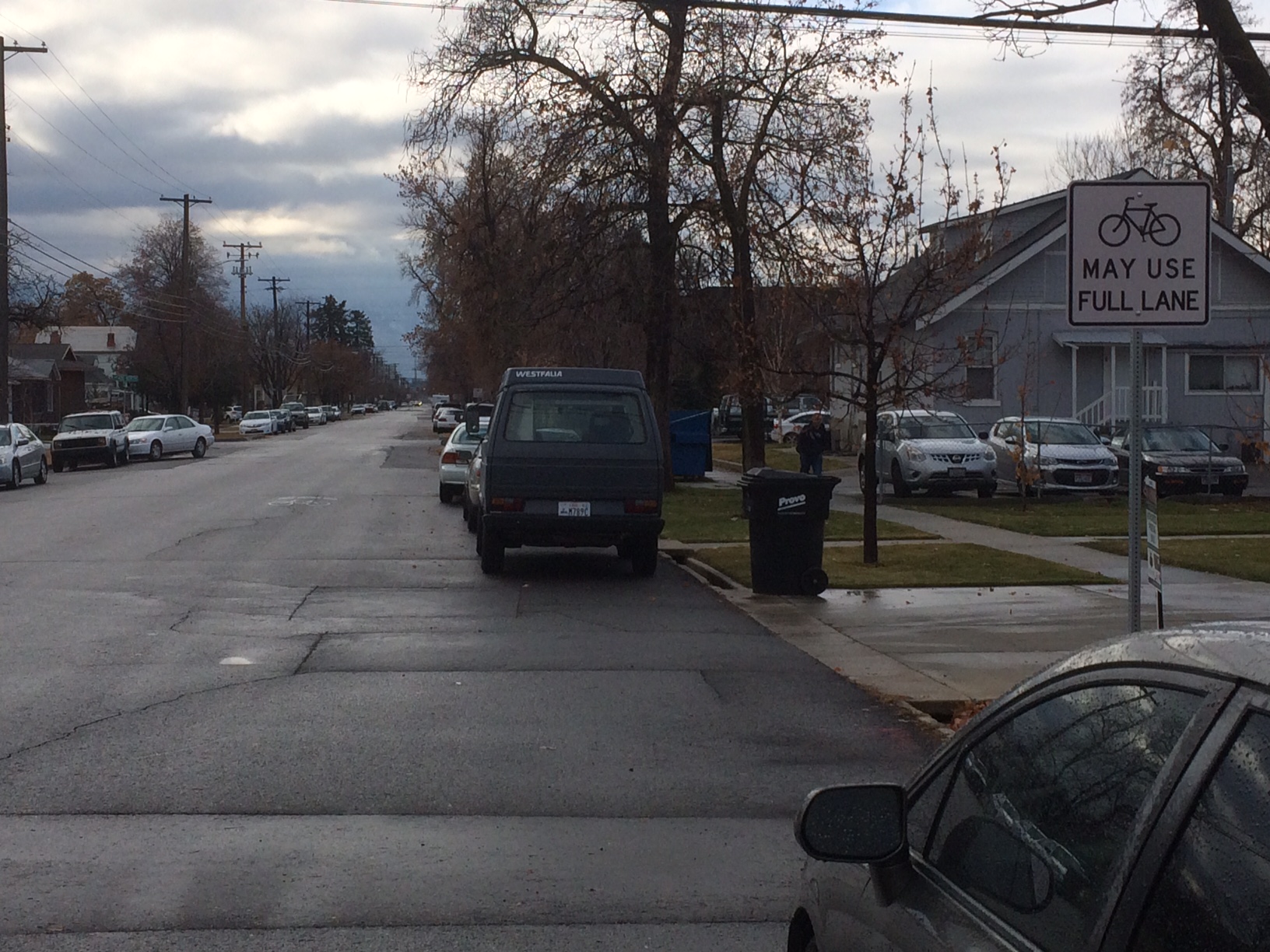
Finally, in recent weeks crews have posted signs telling bicyclists and drivers that “BIKES may use full lane” and painted in shared-lane markers on the street.
More work needs to be done. Way-finding signage needs to be installed. More “BIKES may use the full lane” signs need to go up. The posted speed limit needs to be lowered to 20 MPH from 25 MPH, although these design changes are more important and already encouraging traffic calming and speeds appropriate for a residential street. The bike lane on the east side of the street between 800 and 500 N needs to be removed and on-street parking restored because bicyclists may now use the full lane. The intersection at 800 N needs to be addressed. Here is how Alta imagined it might look like. Isn’t this design, which prioritizes pedestrians and bicyclists going north and south, and vehicles going east and west, a lot better than the mess it is now?


And more sharrow markers need to be painted and “BIKES may use the full lane” signs need to be installed south of Center Street. (The work the city has completed so far has focused on the Joaquin Neighborhood north of Center but in the coming years we can expect to see curb-extensions and these other improvements be implemented south of Center to 600 S in the Maeser Neighborhood.)Â 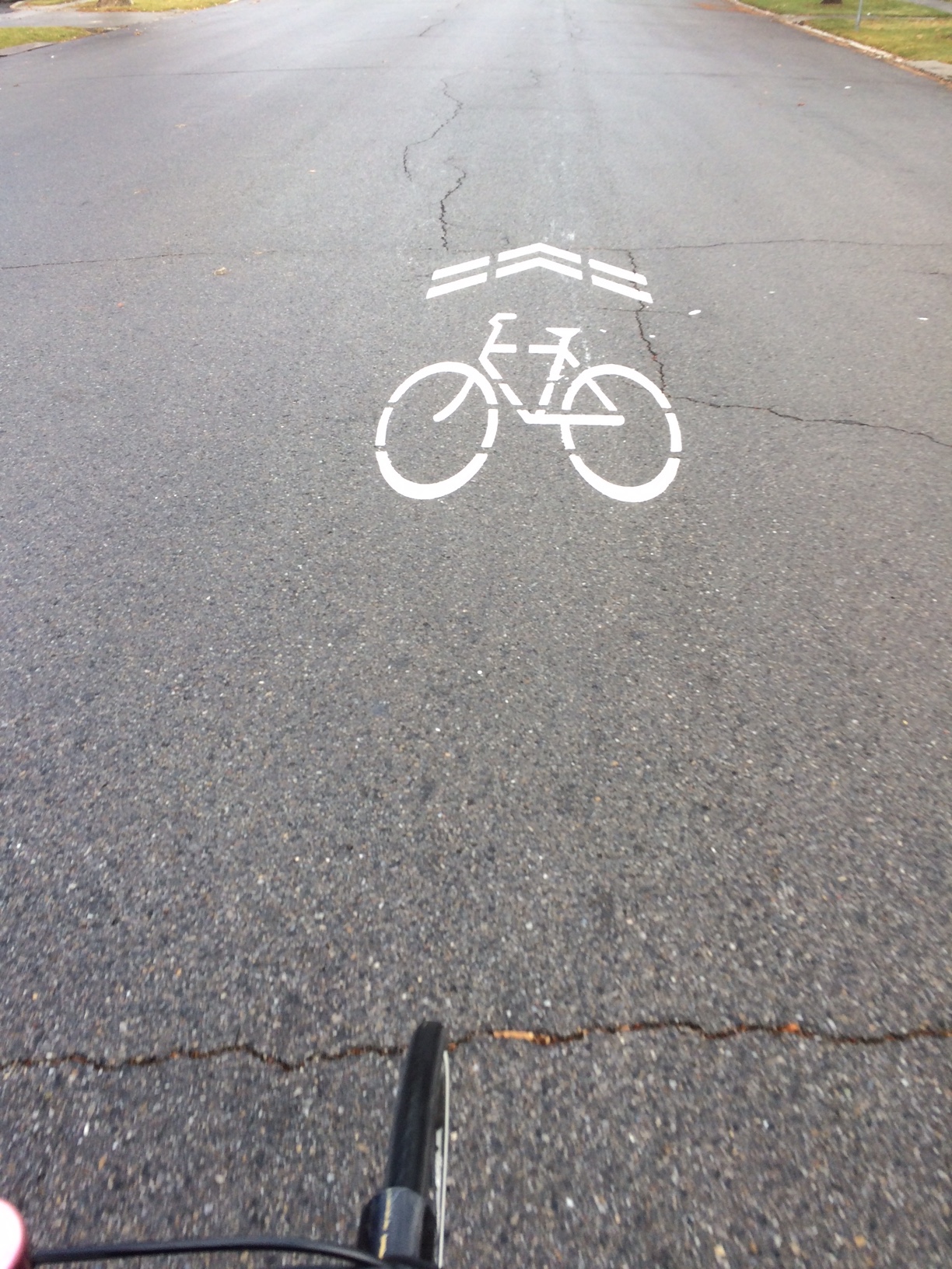
Thanks to collaboration between neighborhoods and the bicycling community and the city’s Public Works Department, UDOT, and UTA, people on bicycle and foot now have a safe(r), pleasant, and convenient way to move along this corridor from the Frontrunner Station, downtown, and BYU. The route connects (or will connect) with other bikeways forming a network that provides people with more choices to move around Provo. In short, these improvements are about giving people transportation choices and improving the quality of life for everyone in our community.
1 comment